I live in Northern California, and we were largely spared by wildfires this year. Southern California was obviously not, and Canada and the East Coast of the U.S. got hit pretty hard last year. Effective wildfire smoke tracking has become a significant area of interest these last few years.
If you’re in the path of a wildfire, get out of the way, obviously. We don’t have much involvement in that process, nor should we. Emergency services are doing their best and will get better about that part as time goes on. The part Wet Dog Weather can help out with is wildfire smoke tracking forecasts.

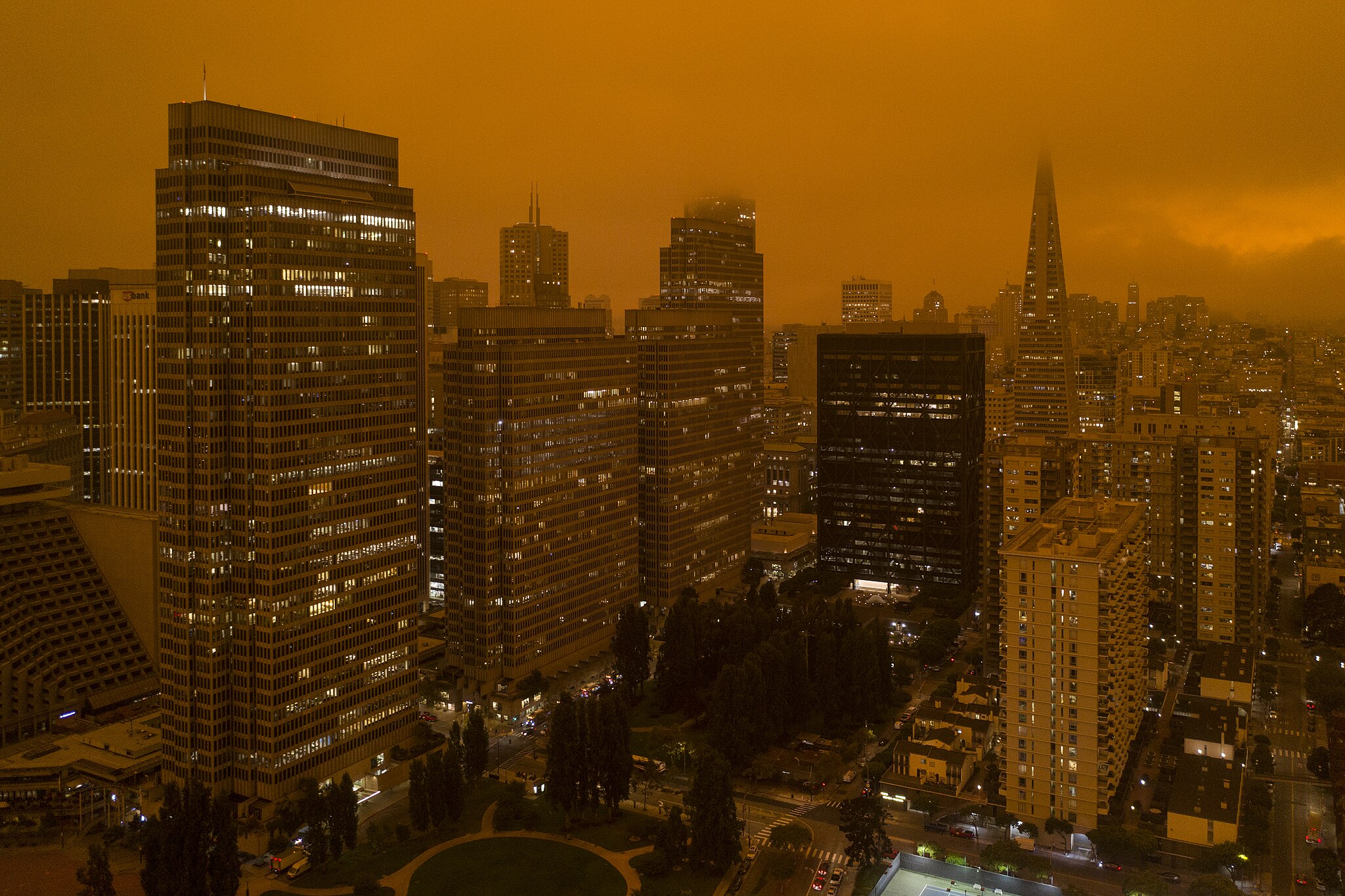
Christopher Michel, CC BY 2.0 <https://creativecommons.org/licenses/by/2.0>, via Wikimedia Commons
Wildfire Smoke Tracking Models
The purpose of particulate models, to use the fancier description, is to predict where smoke and other particles will move over time. Advanced wildfire smoke tracking uses wind prediction, a big part of weather forecasting, so we can do something similar with smoke. And we do.
For years, I’ve tried to talk my customers into showing at least one particulate model alongside the weather. For whatever reason, they’ve never really gone for it. I’m something of a data pusher, so I trust they know their customers. I mean, I want to add GOES data to commercial weather apps ‘because it’s cool,’ so my judgment is highly suspect.
Now, a couple of customers have asked us to add a U.S. smoke model, so we finally get to add one!
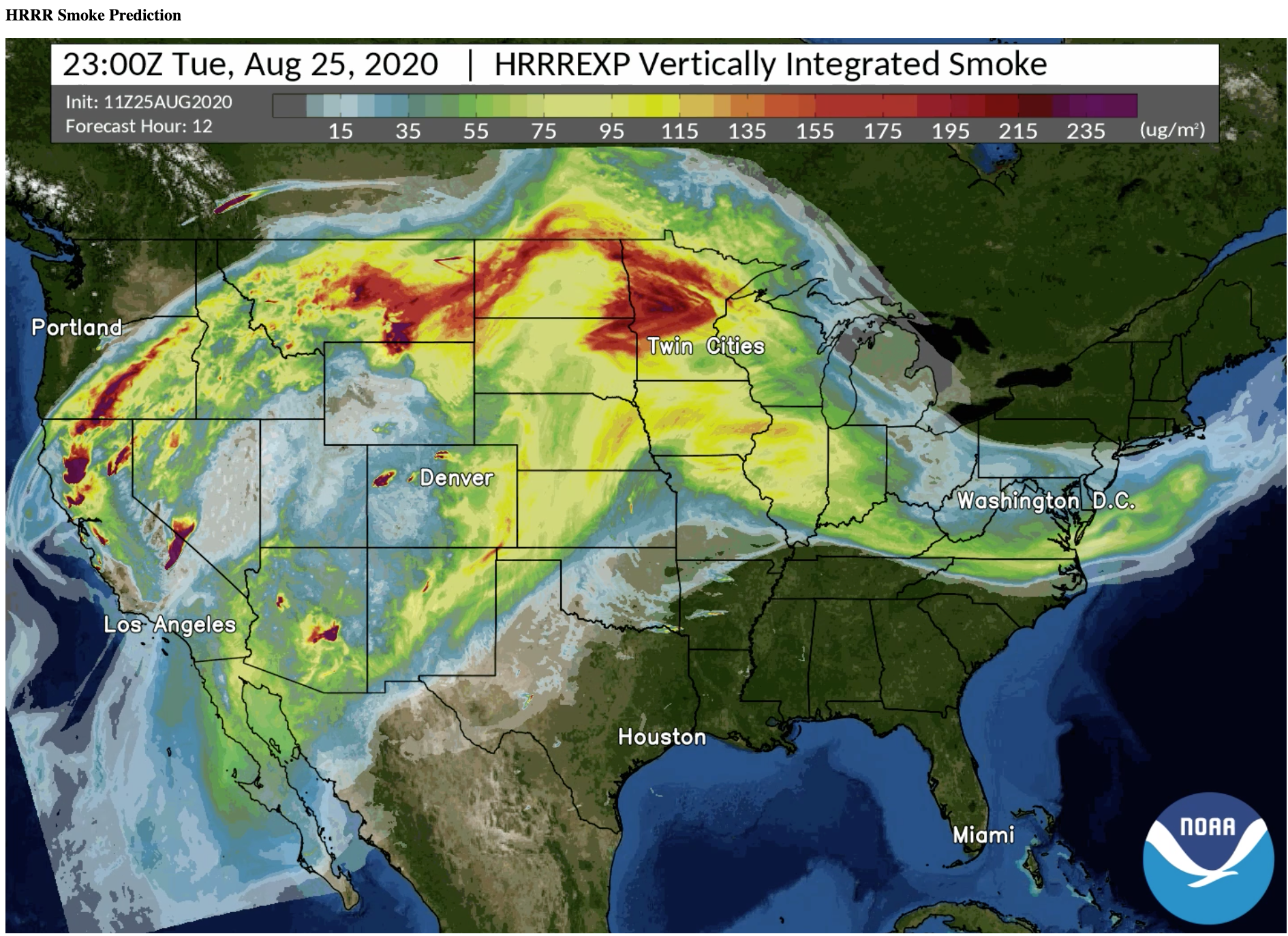
We’ll start with the HRRR Smoke model. We like the form factor of HRRR, which covers just CONUS, and our customers haven’t really moved over to RRFS yet, so it’ll be comfortable.

We’ll probably follow the NOAA coloring to start, as we usually do, and let our customers come up with their own (as they usually do). Surface particulates in the smoke-like range (PM 2.5) will be of great interest. Once we process that, we’ll see what else we might do with our wildfire smoke tracking tools. We’ve been talking to an interested company about this.
Fire Models
There’s some really great work being done in fire modeling, and I’d love to see some of that turn up in consumer products—except…
Any model is going to be wrong in many places—weather, smoke, fire, lightning, you name it. However, weather is one of the few places the public seems to understand probabilities. They understand them by complaining that weather forecasting is always wrong—and that’s incorrect—but still, it’s something. Fire is different, and fire is scary.
If you show someone’s neighborhood burning down, it’s hard to explain that this is just a model that doesn’t consider fire suppression. So, even as wildfire smoke tracking improves, I don’t expect to see real fire models in commercial weather apps very soon.
The Future of Wildfire Smoke Tracking
As climate change intensifies and wildfires become more frequent and severe, wildfire smoke tracking will shift from a nice-to-have feature to an essential public health tool. The smoke doesn’t respect state lines or international borders—as we’ve seen with Canadian fires affecting U.S. air quality—making these models increasingly relevant nationwide.
The data is available, the technology is ready, and now the market demand is finally here. The question isn’t whether wildfire smoke tracking will become standard in weather services but how quickly we can implement robust, user-friendly tools that translate complex particulate data into actionable information for everyday users. That’s the challenge—and opportunity—we’re embracing.

