GeoJSON has long been heralded as the open data format for exchanging geospatial data. And for good reason—its JSON-based structure offers simplicity and readability, making it a favorite among developers and data enthusiasts. It’s great for many things and has handily replaced formats like the venerable Shapefile. However, as with any geospatial data format, strengths and limitations exist.
Let’s explore the pros and cons of GeoJSON so you can better navigate the world of geospatial data formats and choose the right tool for the job.
GeoJSON is Easy to Generate
JSON is the basis for the format. Most people don’t realize that’s an acronym for “At Least It’s Not XML.”
The beauty of JSON is that it’s easy to write without resorting to a toolkit. You can also get every language’s favorite dictionary variant into and out of JSON with minimal effort. It’s readable, too, and easy to paste into a formatter.
Those features make JSON and its geo variant easy for users to access. I often generate some simple debugging JSON in a project before incorporating an actual library to produce it.
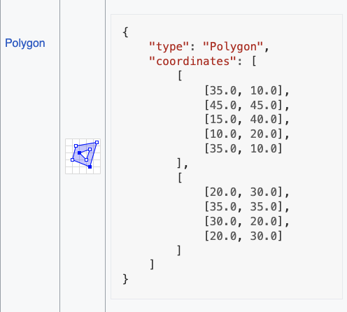
The Geo part is a structure on top of the JSON with definitions for points, lines, polygons, and other such entities. It is easy to produce and relatively easy to parse.

That ease of use is its best feature.
GeoJSON is Good for Geospatial Data Exchange
First of all, the format is good for small things: messages between client and server, country outline, and Waffle House locations in Florida.
It’s also suitable for data that needs to be maximally exchangeable. Even if your favorite tool doesn’t import GeoJSON, you can quickly add that functionality.
If we were to carve that Waffle House GeoJSON onto the side of a space probe, aliens would figure out how to decode that sucker with a little study. They might have some other questions, but that’s beside the point. Send them XML if you want to start a war.
The Limitations of GeoJSON
If you find yourself saying, “A Gigabyte of GeoJSON, uncompressed,” then you crossed that line. In fact, you went zooming past it. Wave as you go by. The makers of storage systems will thank you.
As with any technology, GeoJSON has its limitations. When dealing with massive geospatial datasets – think gigabytes of uncompressed data – the format’s verbose nature can quickly become a burden. All those attributes duplicated across features can bring your application to a crawl as it struggles to parse the incoming data.
The other day, I set up a system to return GeoJSON in little bitty tiles and found my app spending most of its time—you guessed it—parsing GeoJSON. That wasn’t a good use case.
If your use case is better suited for a tabular data structure, GeoJSON’s streaming nature may not be the best fit. The absence of a traditional database-style file format, like the venerable Shapefile’s DBF, can make certain data manipulation tasks more cumbersome.
When to Use (and Avoid) GeoJSON
So, when should you reach for GeoJSON, and when should you steer clear? As with most things in the world of technology, it’s a matter of balance and understanding your specific needs.
If you’re dealing with smaller, highly exchangeable geospatial datasets, GeoJSON is likely the way to go. Its ease of use and widespread support make it an excellent choice for client-server communication, basic visualizations, and other lightweight applications.
However, if you’re working with massive datasets or your use case is better suited for a tabular data structure, it may be worth exploring alternative geospatial data formats that can better handle those requirements.
Ultimately, choosing a geospatial data format comes down to understanding each option’s strengths and limitations and selecting the one that best fits your project’s needs. GeoJSON may not be the be-all and end-all, but it remains a valuable tool in the toolkit.
Long live GeoJSON!

